A first drive
See entrances, Woodlands Trace, visitor facilities and the shape of the entire peninsula.
Visitor map PDF ↗Land Between the Lakes · Kentucky & Tennessee
The peninsula is longer than it looks on a phone. Find the map that fits your trip, save it before you lose service, and check what has changed before you turn off the highway.
Source-checked October 1, 2026 · Route and campsite maps link to official LBL files.
One map does not do every job
Start with the broad visitor map. Add a trail or campground sheet when the details matter. If you will drive Forest Service roads, the current motor-vehicle map is the authority for designated routes—not the colorful visitor brochure.
See entrances, Woodlands Trace, visitor facilities and the shape of the entire peninsula.
Visitor map PDF ↗Choose a trail-specific sheet for route junctions, access points and permitted uses.
Browse trail maps ↓Match your campground loop and exact site to the official campground plan.
Browse campground maps ↓Use the 2026 Motor Vehicle Use Map to check designated roads and seasonal restrictions.
2026 MVUM PDF ↗Get your bearings
These are unaltered crops of the official visitor brochure, presented as previews. Open the full PDF for its legend and complete coverage; use the dedicated recreation PDFs for a closer look.
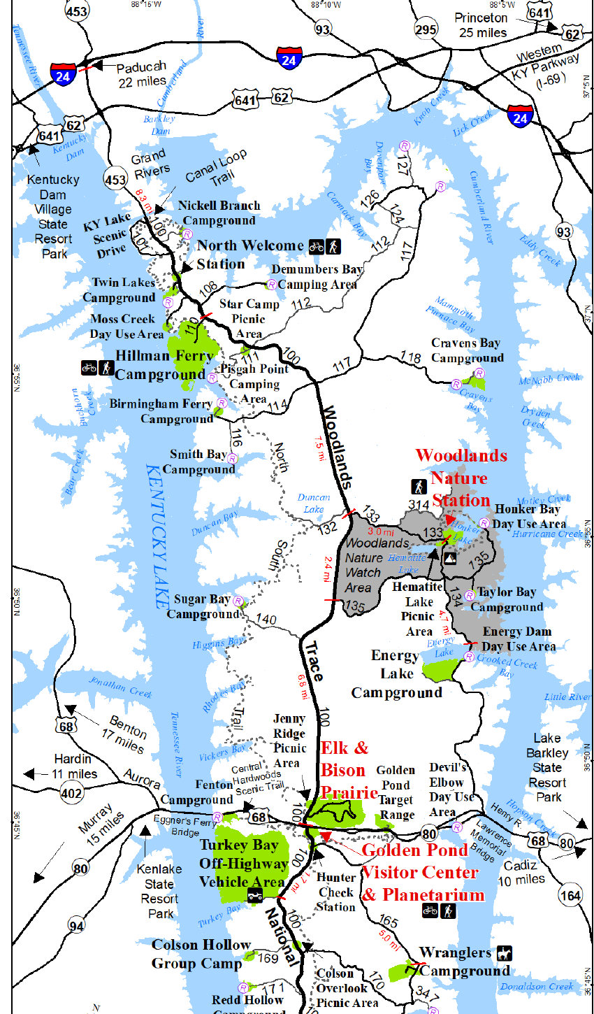
Use this side for Hillman Ferry, Canal Loop, the Woodlands Nature Station, Hematite Lake and the visitor center.
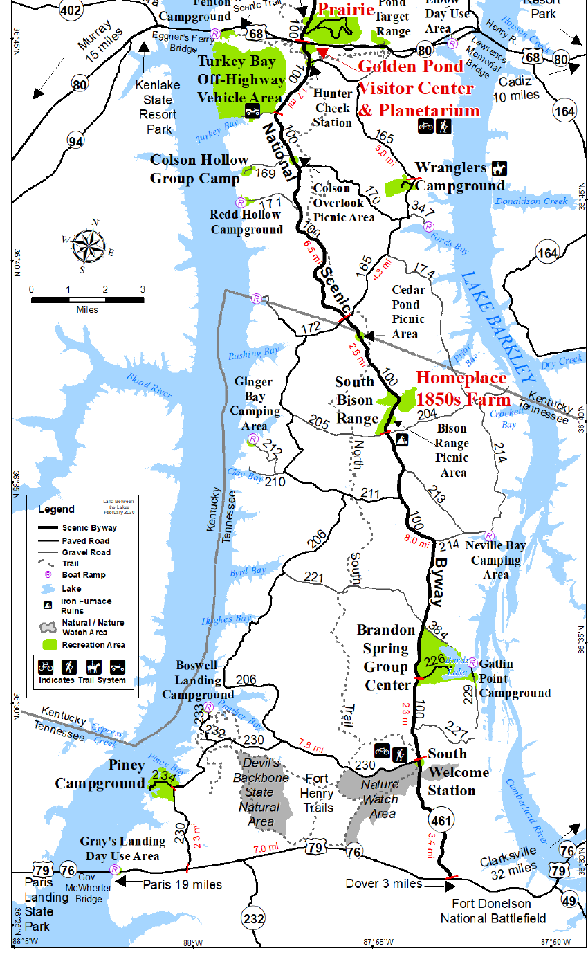
Start here for the Homeplace, Fort Henry country, Piney Campground and the southern entrance.
Map imagery: USDA Forest Service visitor brochure, revised 2023. The recreation PDFs are labeled 2022 by LBL. Neither preview is a live road-status display.
For the turn after the trailhead
A trail sheet is where you find connectors, access points and use restrictions. Download it at home; cell service is not a dependable navigation plan inside LBL.
The longer outer loop and its shorter connector choices near the north entrance.
Use the access-point map to plan a section rather than assuming one out-and-back distance.
Several connecting trails; check the official closure notice before choosing a loop.
Rugged sections and multiple road crossings make the section map essential.
Read the official detour notice with this map; a mapped line may not be passable.
Start with the Nature Watch trail directory for current route information.
Your site, not just your campground
Use the PDF alongside the live reservation listing. A campground map helps you see loops and facilities; it does not guarantee that a particular site is available or that its services have not changed.
Make the map work when the phone does not
Do these three things while you still have a reliable connection. Then let the landscape—not a loading spinner—set the pace.
Open the official map library ↗